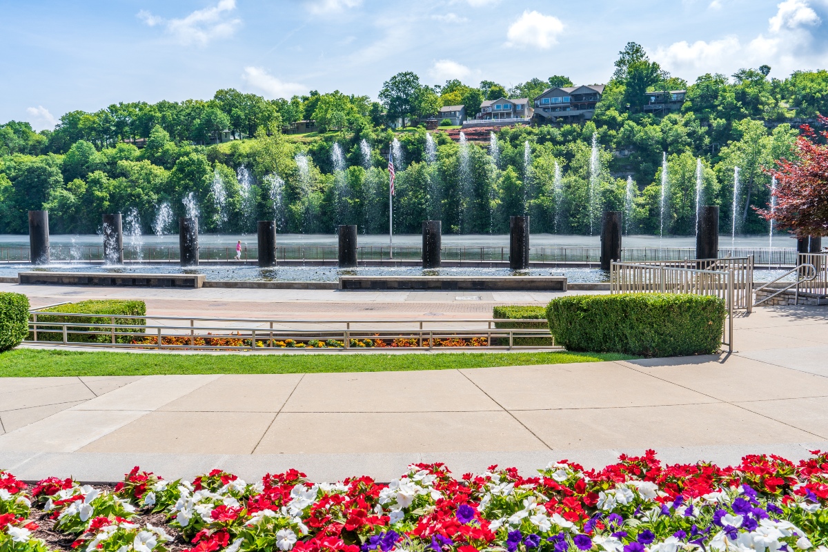

If you’re an outdoor enthusiast looking for some beautiful hiking trails, there are some spots in Branson, Missouri that are worth making a trip to see.
Of course, there’s always plenty you can do as well as affordable hotels in Branson, so making a mini vacation out of your hiking trip is easy to do.
According to the Branson/Lakes Area Convention and Visitors Bureau, there are over 200 miles of publicly accessible hiking trails in Branson with varying degrees of length and difficulty.
So, no matter your experience, we’ve got a trail or two that should peak your interest.
Lakeside Forest Wilderness Area Hiking Trails
When it comes to the best hiking trails in Branson, Lakeside Forest Wilderness Area might be the go-to spot.
If you were planning on trying to hit up other places in town before or after your hike, it’s in a super convenient spot not too far off the strip on Highway 76.
This area has three of the top 10 trails in Branson as voted by people on AllTrails.
One of the most popular is the Bluff, Bent Tree, and Ridgetop Loop which is about 2.3 miles and will get your heart rate up at times but should be fairly easy to accomplish.
You’ll get a beautiful view of Lake Taneycomo and there’s hand-built stone walls and over 300 stone steps along the way.

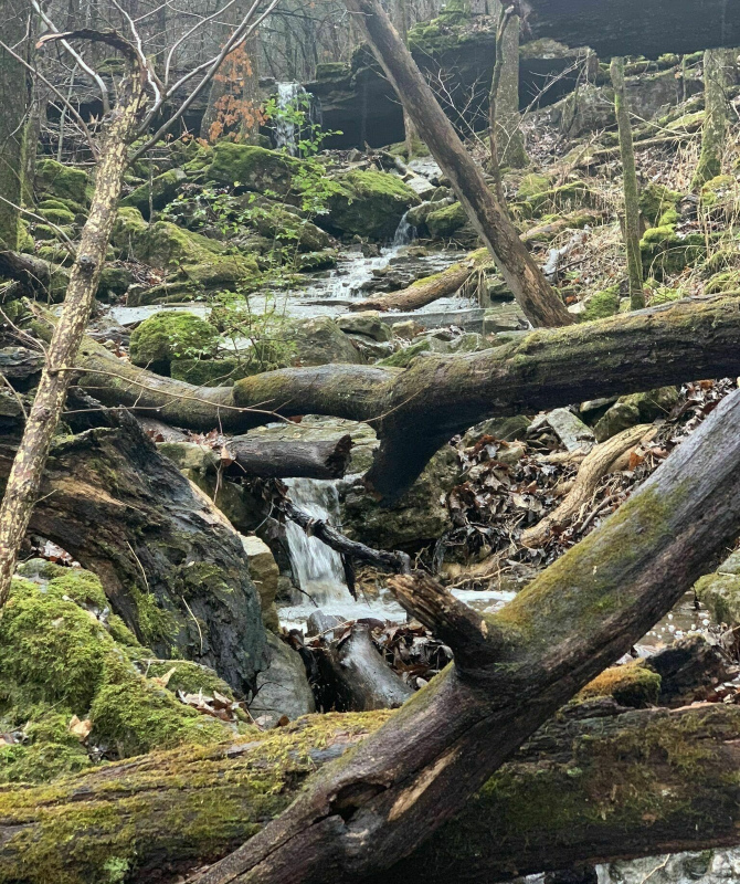
A shorter trail you can take (or add in to your hike, all the trails here are connected) is the Bluff Trail to Cave which is 1.5 miles. Don’t let the short distance fool you, however. This is definitely a moderately difficult trail.
The effort is definitely worth it, though. On this loop you can see a waterfall and a few cave entrances.
Looking for a quicker, kid-friendly hike that still gets everyone immersed in nature?
The Stonewall Trail is only a mile but takes you along, you got it, hand-built stone walls to the historic Owen Homestead.

Table Rock State Park hiking trails
Table Rock State Park also has several trails, with two among the top 10 on AllTrails.
There’s three groups of trails at Table Rock – Chinquapin Trail, Table Rock Lakeshore Trail, and White River Valley Trail System.
White River Valley’s trail system has the two highest rankings for Table Rock on AllTrails.
The first is a combination of the red, blue, orange, and green loops which features 11.5 miles of trails.
Obviously, this will take several hours no matter the level of experience. However, you don’t have to take all the connectors and can shorten your hike as you see fit.
In trade for your efforts, you’ll get a fun trek through the park on a moderately difficult, natural trail with gorgeous views of Table Rock Lake, the White River, and small, natural waterfalls.
If you want to take just one of the trails along White River, the Red trail is the one recommended on AllTrails. It’s 2.9 miles.
However, according to the park’s website, this is the most technically challenging even with an elevation change of only about 120 feet.
Don’t worry, you’ll still get a view of a natural waterfall along the way.
If you’re looking for something super easy, the Table Rock Lakeshore trail is a flat, paved trail. Be aware, this trail does not loop around, so you’ll have to turn around at some point.
If the name didn’t give it away, this trail runs along the shoreline and provides a fantastic view of the lake.
Finally, there’s Chinquapin Trail, another relatively flat trail that’s only 1.2 miles. It shares part of the Lakeshore trail but also has a good mixture of the Ozark glades and woodland area.
Ruth and Paul Henning Conservation Area trails
Another set of trails near the White River, the Ruth and Paul Henning Conservation Area is in the White River Hills on the west side of Branson.
If you just take the whole loop, starting with the Glad Trail, it’s about 5.5 miles and will take nearly three hours to complete.
Along the way you’ll see Boulder Bald, Dewey Cove, and several homestead sites. Be sure to stop and take a look from the 40-feet viewing tower atop Dewey Bald for a fantastic view of the White River Hills.

Fun fact according to the site’s website: the glades in the area (or balds as locals refer to them) are important to local history and folklore of the region. Apparently, post-Civil war vigilante groups often met on the balds, and became known as baldknobbers.
If you want to cut about two miles out of your hike, you can just take the Homestead Trail.
Either way, you’ll get good views of the river, streams, and forest.
When you’re done with your hike, relax at Grand Oaks Hotel!
After a full day of hiking and exploring Branson, get some rest in an affordable, yet luxurious room at Grand Oaks Hotel.
If you really want to unwind, you can book our jacuzzi king that has a private jacuzzi in your room!
Visit Branson often and looking for a way to save? Join our loyalty program to get discounted rates on all of our rooms!
To get more information, just submit your email below.